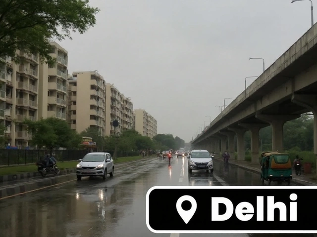
Delhi weather: IMD scales down alerts as rain eases, Yamuna stays above 207m
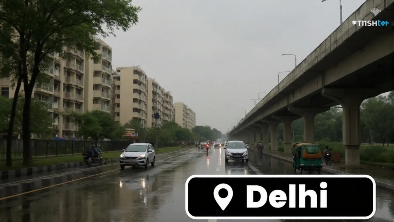
After days of disruptive downpours that pushed the Yamuna above the evacuation threshold, Delhi weather is finally turning a corner. The India Meteorological Department (IMD) has dialed back its warnings, signaling a clear step-down in intensity for the National Capital Region. Expect cloudy skies, light rain or brief thunderstorms, and a gradual return to manageable conditions as the weekend approaches.
The tone shift is significant: red and orange alerts earlier this week have been downgraded to yellow for Delhi. That means be cautious, but don’t expect the kind of prolonged, flooding rain that brought parts of the city to a standstill. The IMD says active monsoon conditions will linger for the next four days, with one or two light spells each day. By the weekend, most showers should be short and scattered. Rainy conditions are likely through September 7, followed by mostly cloudy skies until September 9.
Why the alert was downgraded
The IMD’s color codes are simple: red signals extreme risk, orange warns of heavy rain likely to disrupt daily life, and yellow tells you to stay aware because isolated weather events can still pop up. Delhi moved from red/orange to yellow as the heaviest rain bands shifted and the overall moisture feed weakened. That trend should hold unless a fresh low-pressure system revives the monsoon trough over northwest India.
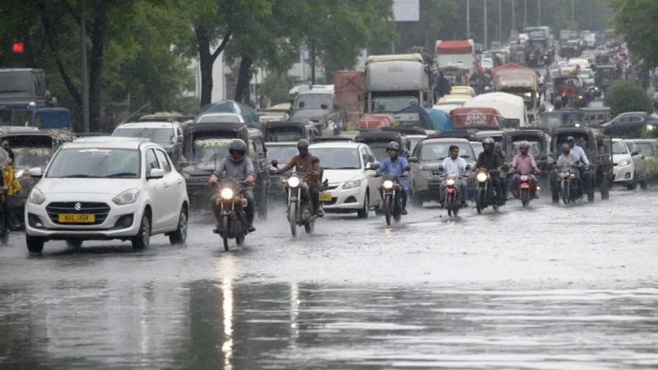
Wednesday’s numbers capture the transition. Delhi’s maximum temperature settled at 32.3°C, about 1.8°C below normal for this time of year. The minimum dipped to 22.8°C—roughly 2.8°C under the seasonal average. Winds were mostly southeasterly, steady near 15 kmph and gusting up to 30 kmph in the past 24 hours. In plain terms: cooler than usual, breezy, and muggy—but without the punishing downpours.
What typically cools a wet spell like this? A weakening of the low-pressure system feeding the monsoon, plus an oscillation of the monsoon trough. When those ease, the conveyor belt of deep clouds breaks up. That’s when you get today’s pattern: more cloud than sun, a few short showers, and gaps long enough for commutes to mostly run on schedule.
The pattern won’t be identical across the NCR. Gurugram sits under an orange alert for moderate rainfall, meaning localized waterlogging is still possible there, especially around underpasses and construction zones. Noida and Ghaziabad remain on a yellow warning for light rain and thunderstorms. The IMD also flags isolated heavy rain over parts of Haryana and Chandigarh, which can trigger brief surges in local streams and drains even if Delhi itself is quiet.
The rain has already improved air quality. Delhi’s AQI touched 57 (satisfactory) on Wednesday afternoon, with PM2.5 at 29 µg/m³ and PM10 at 75 µg/m³, according to CPCB readings. Rain scavenges particulates out of the air, so you breathe easier for a bit. This bonus is usually temporary—once the skies dry out and traffic peaks, numbers climb again—so it’s a good time for outdoor errands if you’ve been waiting for cleaner air.
River, transport and daily life: what changes next
Even as the skies calm down, the Yamuna remains the bigger story. The river stood at 207.44 metres on Wednesday night—above the 207-metre evacuation mark—for the second day in a row. That’s rare territory: it’s only the fifth time since 1963 that this threshold has been crossed. With the river breaching its banks, cremations at Nigambodh Ghat were temporarily suspended after water entered the complex.
What should you watch for on the river front? Releases from the Hathnikund barrage upstream in Haryana often decide Delhi’s flood risk. Lighter local rain helps, but river levels respond to upstream inflows with a lag. That means receding water in the city can take a while even after the weather eases. Floodplain seepage can also keep low-lying stretches wet for days.
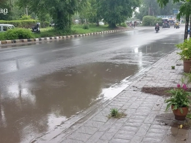
Inside the city, the switch from relentless rain to sporadic showers will reduce new waterlogging. But the usual chokepoints—underpasses, stretches near major drains, and roadworks—can still flood briefly during a thundershower. With gusts around 30 kmph reported, a squall can also bring down a tree or two and delay traffic. Expect road crews to continue barricading vulnerable spots and draining pooled water through the weekend.
Travel remains a mixed bag. Airlines have warned about weather-related delays and occasional cancellations this week. Keep buffer time for airport runs, and check your flight status before leaving home. Trains are generally more resilient, but localized flooding around yards and level crossings can slow movement. Inside the city, traffic will likely improve day by day as showers break up, though a single strong cell over a busy corridor can still cause 45–60 minute snarls.
Here’s what to do over the next few days:
- Avoid riverbanks and floodplains, especially after dark. Water levels can change quickly.
- Do not drive through water deeper than the bottom of your car door. Engines hydrolock fast.
- Park away from trees and high-tension lines during thunderstorms.
- Carry a rain jacket and a small torch in your bag or glovebox. Short power or signal glitches happen.
- For sensitive groups, use the cleaner-air window after rainfall for outdoor activity; wear a mask if dust rises as roads dry.
What the rest of the week looks like, at a glance:
- Thursday: Generally cloudy. One or two light spells; brief thunder possible.
- Friday: Mostly light rain; a pocket of moderate rain can develop at isolated spots.
- Saturday: Intermittent drizzle or short showers; longer dry breaks for errands and events.
- Sunday: Similar to Saturday—cloudy, mainly light and brief rain.
- Monday–Tuesday (up to Sept 9): Cloud-dominant with limited rain, unless a fresh system forms.
Numbers tell the bigger monsoon story. Delhi has already crossed 1,000 mm of rain this season, well above the city’s annual average of 774 mm. That’s why you’ve seen repeated flooding headlines despite long dry gaps between events. The IMD also expects September rainfall to be above normal nationally—about 109% of the Long Period Average (LPA). LPA is simply the 30-year mean for a given month; when it’s exceeded, you get more rain days or bigger bursts, or both.
If you’re wondering how a month can be “above normal” while your neighborhood looks dry for two days, here’s the catch: monsoon rain comes in pulses. A wet week, a lull, then another wet spell. Urban flooding issues add to the mess—concretized surfaces, clogged drains, and construction that blocks flow paths turn even moderate rain into ankle-deep water where it shouldn’t be.
River risk is cyclical too. The evacuation threshold of 207 metres is a late-stage warning that triggers movement out of the most vulnerable zones. The city also monitors a danger mark and relies on continuous gauge readings to guide evacuations and relief. In 2023, the Yamuna hit a modern record of around 208.66 metres, a reminder that rare peaks do happen and can overwhelm embankments and services.
Health-wise, easing rain cuts the chance of prolonged damp and mould indoors, but puddles linger. That’s when mosquitoes breed. Clear standing water around homes and society blocks, and keep window screens shut at dusk. If you wade through dirty water, wash your feet and legs; minor cuts can get infected fast in monsoon grime.
Lightning is another underappreciated risk in light-rain days. A short, intense thunder cell can bring frequent strikes even without a long shower. If skies darken and thunder cracks close by, get indoors; inside a hard-top vehicle is fine if you’re on the road. Avoid open terraces and metal railings until it passes.
For those tracking the forecast closely, the pivot to yellow is good news, but it’s not a free pass. Yellow means the weather can still surprise you in pockets—one neighborhood can get a soaking while another stays dry. That’s the nature of convection in late monsoon. Keep an eye on official bulletins through the weekend, especially if you live near the river or have outdoor plans in Gurugram and western NCR where a moderate burst remains on the table.
Bottom line: the city is past the most punishing phase of this spell. The Yamuna will take longer to calm, and waterlogged corners will need a couple of dry days to drain out. Plan travel with some cushion, keep riverbanks off your itinerary, and use the clearer windows to get things done. The active monsoon hasn’t left—it's just taking a breather.